Plans & Projects
Trip planner
Plan your trip here
Directions
METRO strives to create and maintain a transit network that is useful, attractive, and relevant to Santa Cruz County. Our community’s mix of rural and urban areas plus its dynamic geographic and topographical landscape offer a unique set of transportation challenges. We create solutions to meet them.
Current Projects
Reimagine METRO
Reimagine METRO ushered in a new wave of bus service improvements, increasing service in Santa Cruz County by over 50 percent.
Rapid Corridors
METRO is making transit between Watsonville and Santa Cruz faster, more reliable, and more accessible.
Bus Stop Improvements
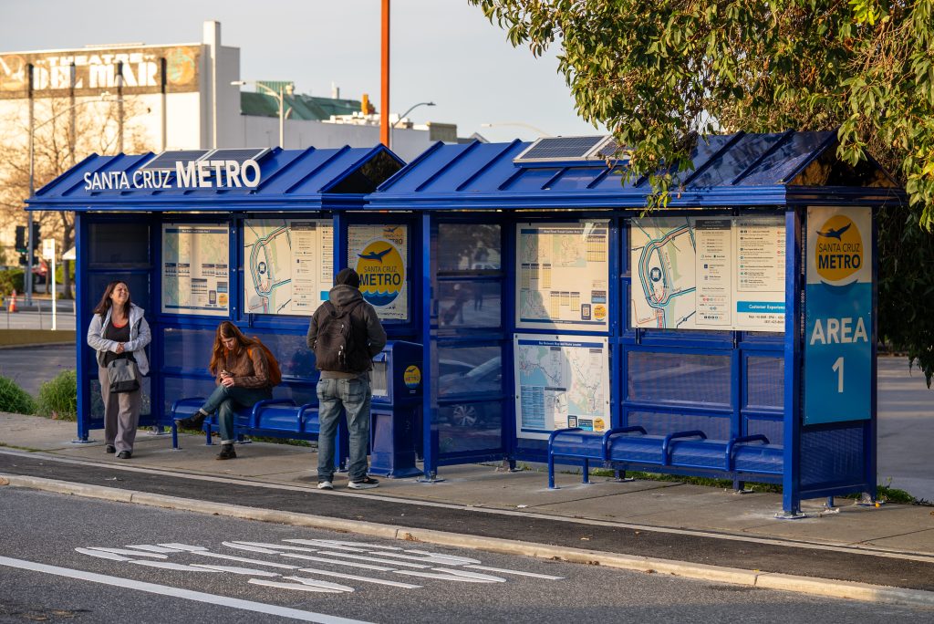
Through the Bus Stop Improvement Project, we are installing 30 bus shelters, bus benches, and trash cans at METRO bus stops.
Affordable Housing
We are redeveloping our Santa Cruz and Watsonville transit centers with the goal of providing 175 new affordable housing units by 2033.
One Ride at a Time
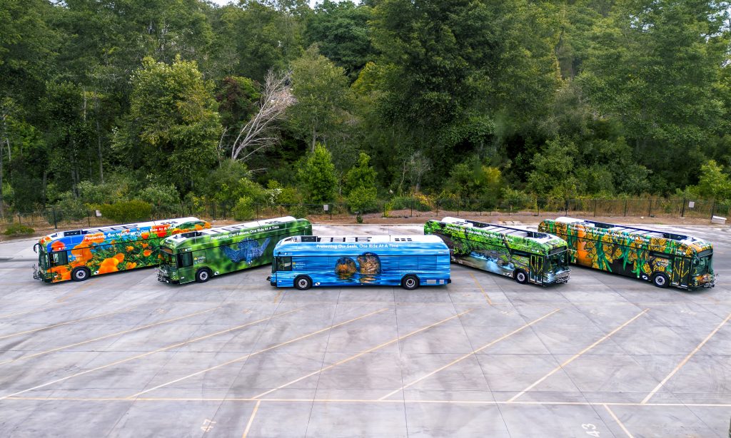
One Ride at a Time is a campaign that gives everyone in Santa Cruz County an opportunity to protect our extraordinary natural resources by simply riding the bus.
Zero-Emissions Fleet
We have an aggressive strategy to convert the entire METRO bus fleet to zero-emissions vehicles by 2037, three years ahead of the California deadline.
Youth Cruz Free
With Youth Cruz Free, K-12 students can ride free on any fixed-route METRO bus in Santa Cruz County.
Projects Archive
METRO Studies & Reports
FY24 Fourth Quarter Ridership Report
Zero Emissions Bus Analysis and Rollout Plan
Other Capital and Operating Grants
2012 Watsonville Transit Planning Study – Chapters 1-3
2012 Watsonville Transit Planning Study – Chapters 4-5
2012 Watsonville Transit Planning Study – Chapter 6, Appendix
Santa Cruz County Regional Transportation Commission Studies & Report
Highway 9 San Lorenzo Valley Corridor Transportation Plan
Cruz511 “In your Neighborhood”
Agenda Excerpt Re: Pedestrian Safety Work Group’s Pedestrian/Motorist Brochure (2014)
Developer Resources
What is GTFS?
The General Transit Feed Specification (GTFS) is an Open Standard used to distribute relevant information about transit systems to riders. It allows public transit agencies to publish their transit data in a format that can be consumed by a wide variety of software applications, including Google and Apple Maps and the Transit App. Today, the GTFS data format is used by thousands of public transport providers.
GTFS consists of two main parts: GTFS Schedule and GTFS Realtime. GTFS Schedule contains information about routes, schedules, fares, and geographic transit details, and it is presented in simple text files. This straightforward format allows for easy creation and maintenance without relying on complex or proprietary software.
GTFS Realtime contains trip updates, vehicle positions, and service alerts. It is based on Protocol Buffers, which are a language (and platform) neutral mechanism for serializing structured data.
GTFS Feeds
GTFS Schedule (Static) Feed
GTFS Real-Time Feeds
- Trip Updates: rt.scmetro.org/gtfsrt/trips
- Vehicle Position: rt.scmetro.org/gtfsrt/vehicles
- Service Alerts: rt.scmetro.org/gtfsrt/alerts
Feed License
This work is licensed under the Creative Commons Attribution 4.0 International License as well as the SCMTD Developer License Agreement below.
Feed Documentation
GTFS Schedule: gtfs.org/schedule/reference
GTFS Realtime: gtfs.org/realtime/reference
Projects Archive
METRO Studies & Reports
FY24 Fourth Quarter Ridership Report
Zero Emissions Bus Analysis and Rollout Plan
Other Capital and Operating Grants
2012 Watsonville Transit Planning Study – Chapters 1-3
2012 Watsonville Transit Planning Study – Chapters 4-5
2012 Watsonville Transit Planning Study – Chapter 6, Appendix
Santa Cruz County Regional Transportation Commission Studies & Report
Highway 9 San Lorenzo Valley Corridor Transportation Plan
Cruz511 “In your Neighborhood”
Agenda Excerpt Re: Pedestrian Safety Work Group’s Pedestrian/Motorist Brochure (2014)
Developer Resources
What is GTFS?
The General Transit Feed Specification (GTFS) is an Open Standard used to distribute relevant information about transit systems to riders. It allows public transit agencies to publish their transit data in a format that can be consumed by a wide variety of software applications, including Google and Apple Maps and the Transit App. Today, the GTFS data format is used by thousands of public transport providers.
GTFS consists of two main parts: GTFS Schedule and GTFS Realtime. GTFS Schedule contains information about routes, schedules, fares, and geographic transit details, and it is presented in simple text files. This straightforward format allows for easy creation and maintenance without relying on complex or proprietary software.
GTFS Realtime contains trip updates, vehicle positions, and service alerts. It is based on Protocol Buffers, which are a language (and platform) neutral mechanism for serializing structured data.
GTFS Feeds
GTFS Schedule (Static) Feed
GTFS Real-Time Feeds
- Trip Updates: rt.scmetro.org/gtfsrt/trips
- Vehicle Position: rt.scmetro.org/gtfsrt/vehicles
- Service Alerts: rt.scmetro.org/gtfsrt/alerts
Feed License
This work is licensed under the Creative Commons Attribution 4.0 International License as well as the SCMTD Developer License Agreement below.
Feed Documentation
- GTFS Schedule: gtfs.org/schedule/reference
- GTFS Realtime: gtfs.org/realtime/reference